|
|
 |
|
|
|
Precipitation Data and Site Observations
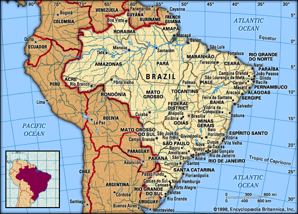
For this project I wanted to examine the precipitation
and seasonal variations in Brazil. I thought Brazil would be an interesting
country to study since it is located so close to the equator. I picked
seven different sites around Brazil, ranging from sites on the coast to
sites deep within the Amazon. I then looked at the precipitation graphs
and observed how they varied from season to season. For the Web page I
have chosen three sites that show the range in precipitation due to seasonal
variations and location.
Climate in Brazil
Brazil has a humid tropical and subtropical climate except for a semiarid area in the northeast, sometimes called the drought quadrilateral or drought polygon, that extends from northern Bahia to the coast between Natal and Sao Luis and receives only between 15 and 30 inches of precipitation a year. Most of a the rest of the country gets a moderate amount of rainfall, between 40 and 70 inches a year; exceptions to this are certain parts of the Amazon Basin and the sea-facing rim of the Serra do Mar, where the rains are much heavier.
In typical monsoonal fashion, the high-pressure system over the Brazilian Highlands during the summer months is replaced by a low-pressure one that pulls in warm moist air from both the South Atlantic and the North Atlantic high-pressure systems, the latter picking up more moisture as it passes over the forests of the Amazon region. Where these meet along the intertropical convergence zone (ITCZ), torrential downpours occur, amounting to more than 12 inches a month; thus central Brazil has a wet-dry tropical climate. These are critical months in the semiarid northeastern region, which normally receives its precipitation from the easternmost edge of the shifting ITCZ; in more than half the years , however, it either swings too far east, causing floods, or it does not reach the area at all, bringing drought that is sometimes prolonged for years.
Temperatures in Brazil are remarkably uniform during the summer months (November to April), averaging about 79 degrees F over most of the lowlands in January, and a few degrees less in the highlands, depending on upon elevation. The coast of Rio Grande do Sul is also somewhat cooler, averaging around 73 degrees F, where the interior of the drought quadrilateral (Northern Bahia to the coast between Natal and Sao Luis), the hottest region of the country, averages about 84 degrees F with daytime temperatures over 100 degrees F in the summer. Winter temperatures (May to October) in the Amazon lowland remain virtually unchanged from those of the summer months, but they drop to about 79 degrees Farienheight in the drought quadrilateral.
| Group Seven Main Page |
| Topography of the Andes Mountain |
| Precipitation and seasonal variations in Brazil |
| Precipitation throughout the Tropics |
| Conclusion |
| ATMOS 211 Web Page |